Research
My research passion is to understand how climate change may be impacting the habitats of our most vulnerable species and ecosystems. This passion started in my undergrad at Vancouver Island University, where I pursued an independent research project investigating the habitat of the endangered Vancouver Island marmot. Later, while working at the Mount Arrowsmith Biosphere Region Research Institute, I was involved with a variety of research projects, including an extensive plant phenology research and monitoring project that attempts to connect shifting coastal plant phenology with micro-climate data. In 2022 I completed my MSc at the University of Alberta, where I researched the spatial ecology of a subpopulation of polar bears in relation to changing sea ice conditions and the presence of one of their prey.
These research experiences have inspired me to continue on the path of conservation science and I am excited to continue to expand my knowledge and skill sets as my career moves forward. I am currently looking for open PhD positions to further my research and career goals.
Research Techniques
My current work is primarily focused on current and projected habitat modeling for both terrestrial and marine mammals using R, QGIS, and ArcGIS. I’ve also analyzed home range sizes and movement rates in R. I have experience working with a wide range of data, including telemetry (PTT transmitters), sea ice (NASA Nimbus-7 SMMR and DMSP SSM/I-SSMIS Passive Microwave Data), and terrestrial environmental (e.g., ClimateBC biogeoclimatic zone and snow depth) data.
Publications
Thelin, L., A., Richardson, E., Stenson, G., Hedlin, E., & Derocher, A. (2025). Space use of polar bears (Ursus maritimus) in Davis Strait in relation to sea ice and harp seals (Pagophilus groenlandicus). Arctic Science, 11: DOI: 10.1139/as-2023-0052
Thelin, L., Lewis, J., Gilchrist, A., and Craig, J. 2018. The potential effects of climate change on the habitat range of the Vancouver Island marmot (Marmota vancouverensis). The Canadian Geographer, 62(2): 163-177. DOI: 10.1111/cag.12448.
If you cannot access the papers above, please feel free to email me for a copy: LarissaThelin@gmail.com
Research Funding
Together, the following organizations helped to fund my MSc thesis work.
- University of Alberta
- Natural Sciences and Engineering Research Council (Canada Graduate Scholarships – Master’s Program)
- The W. Garfield Weston Foundation (Weston Family Awards in Northern Research – Master’s Level)
- Canadian Council on Ecological Areas (Stan Rowe Graduate Student Home Place Award)
- Earth Ranger’s (Wildlife Adoption Program)

Completed Research Projects
Injury hotspots of incoming wildlife at Alturas Wildlife Sanctuary
In 2022 I completed a 160-hour Wildlife Conservation and Animal Husbandry Volunteer Internship at a wildlife sanctuary in Dominical, Costa Rica that involved the completion of a small research study. The project involved mapping (in QGIS) the location where each rehabilitated animal was injured since the sanctuary opened (2012-2021). I mapped these locations by injury type (e.g., electrocution vs traffic strike) and determined where hotspots were occurring. The maps that illustrate electrocution hotspots are currently being used to determine the best locations for safe animal crossing to be installed.
Photo to the right by Alessa de Zaldo


Space and habitat use of polar bears (Ursus maritimus) in Davis Strait in relation to sea ice conditions and harp seals (Pagophilus groenlandicus)
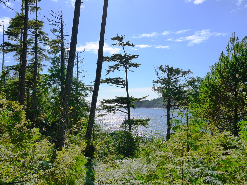
This study was completed for my MSc thesis between 2019 and 2022. Under the supervision of Dr. Andrew Derocher, I investigated the spatial ecology of Davis Strait polar bears relative to harp seals to understand the extent and biological importance of overlap between their space and habitat use. We also examined historical trends in sea ice to provide context for temporal trends in habitat. This study was conducted in R and QGIS and was a partnership between the University of Alberta, Environment and Climate Change Canada, Department of Fisheries and Oceans, and the Government of Nunavut. This study was published in Arctic Science in 2025.
Photo to the left by Andrew Derocher
VIU and the United Nations’ 17 Sustainable Development Goals
This study was completed during my time at the Mount Arrowsmith Biosphere Region Research Institute (MABRRI) between 2018 and 2019. The project involved determining Vancouver Island University’s current progress in meeting the UN’s Sustainable Development Goals, as well as creating a roadmap to better meet these goals in the future. My role was to coordinate this research initiative, including host meetings with VIU faculty and staff, supervise undergraduate research assistants, and oversee the development of the final report.


Coastal Plant Phenology Research & Monitoring Plot
While at MABRRI (2017-2019), I was heavily involved with this ongoing research initiative – a collaboration between MABRRI, the Ministry of Forests, Lands, and Natural Resource Operations, and Milner Gardens & Woodland. The project involves monitoring the phenological changes of coastal native plant species at multiple sites on eastern Vancouver Island, as well as collecting local climate data to link changing micro-climates to shifting plant phenology. My role was to train undergraduate students on data collection and analyses, including overseeing the development of an extensive report completed in 2018.
French Creek Estuary project
While at MABRRI (2017-2019), I was also involved with a project that involved investigating the historical, cultural, ecological, and community values of an undeveloped parcel of land. It was facing potential development and we worked with a local NGO on this study to help protect it as public parkland. My role was to lead the research, including supervise a one-day rapid biological survey involving over 10 staff and community volunteers and oversee the development of a final report.
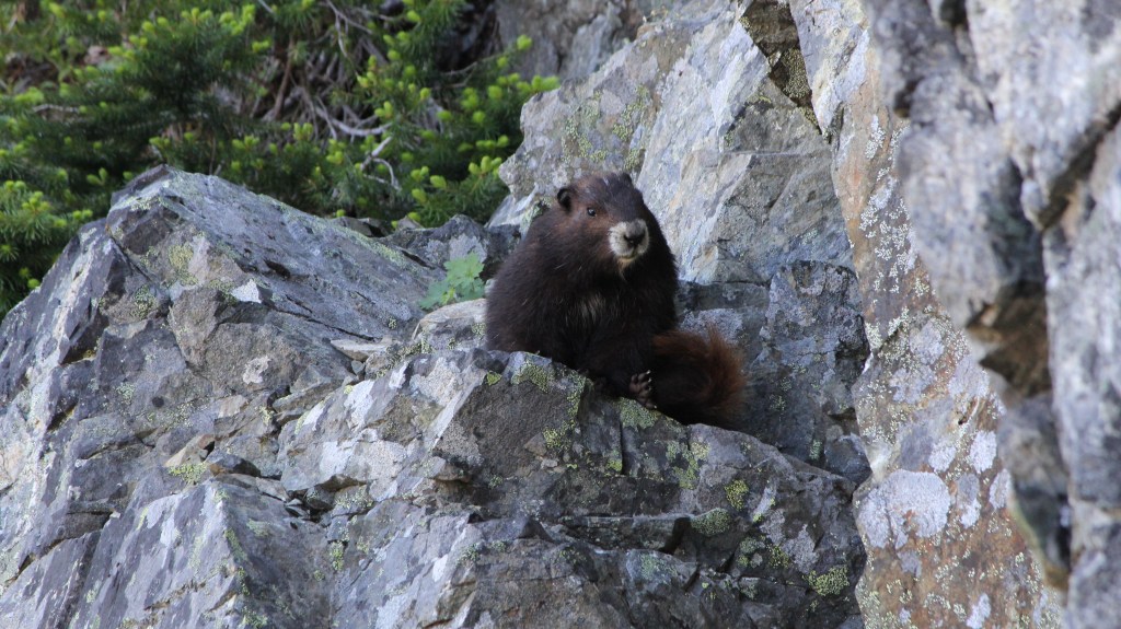
The potential effects of climate change on the habitat range of the Vancouver Island marmot (Marmota vancouverensis)
During my undergrad, I took an elective course (Geography 491: Independent Research Project) from 2015-2016 that allowed me to pursue a research study of my choice. Under the guidance of Dr. Jeff Lewis, I determined and mapped the habitat requirements of Vancouver Island marmots, Canada’s most endangered mammal, in ArcMap. Then, using modelled worst-case carbon scenario biogeoclimatic zone and snow depth data from ClimateBC, I mapped the potential habitat in 2080. After the course-based portion of this project was complete, our model was tested and strengthened using real-life hibernacula data provided by the Marmot Recovery Foundation. The report associated with this updated model was eventually published in The Canadian Geographer in 2018.
Photo to the left by Trevor Dickinson
